
Interactive Map
Loading the corridor…
The proposed KY 536 roadway from Dixie Highway east to Madison Pike (KY 17), including the roundabout at Bristow Road and Mt. Zion Road, drawn over current aerial photography. Lifted from the November 2014 Preferred Design plan sheets.
Drag to pan. Pinch to zoom on a touch screen, or scroll to zoom with a mouse. Double-tap or double-click to zoom in. Click a segment in the legend to jump to it on the map.
Plan sheets prepared for the Kentucky Transportation Cabinet by Stantec and dated November 2014. Reproduced here from publicly available documents; no more recent set is published on this site.
Traffic notices
Closures and traffic changes announced by KYTC District 6. Anything still to come is listed first, then what has already happened. These come from the cabinet's own press releases and project pages. Schedules slip for weather and other reasons, so treat a date as the plan rather than a promise, and check the project hub before relying on one.
Nothing is scheduled that KYTC has announced. The changes below have already taken place.
Already happened
SEPTEMBER 2026
September 22 to 30, 2026
Overnight single lane closures on Turkeyfoot Road for a thin asphalt overlay
Turkeyfoot Road (KY 1303), Kenton County
A separate KYTC preventive maintenance project rather than part of the KY 536 work. Its southern end falls inside the northern part of the Bristow Road widening, and the rest runs north of it. Crews will apply a thin asphalt overlay to 1.66 miles of KY 1303 from north of Beechgrove Drive (mile point 1.05) to south of Brightleaf Boulevard (mile point 2.71), working between 6 p.m. and 6 a.m. Expect single lane closures in the work area during those hours, with one lane open in each direction at all times. The contractor waited for the widening's final surface before starting this stretch. KYTC expects to finish by September 30, weather permitting.
Announced September 18, 2026
September 17 to 19, 2026
Bristow Lakes Drive entrance closing while crews rebuild it
Bristow Road (KY 536), Kenton County
Crews will block the neighborhood entrance to Bristow Lakes Drive around the clock while they reconstruct it, as part of the Bristow Road widening. A single lane of traffic stays open in each direction throughout. Residents can detour using Bristow Road to Williamswoods Drive, which stays open.
Announced September 3, 2026 · KYTC project hub
September 10, 2026
Traffic shifting back to the inside lanes on Bristow Road
Bristow Road (KY 1303), Kenton County
Motorists now use the inside travel lanes throughout the project area while crews carry out final paving and striping on the outside lanes. KYTC expects the configuration to stay in place for several days. It follows the September 8 switch onto the outside lanes, which let crews finish the inside lanes and the center turn lane first.
Announced September 10, 2026 · KYTC project hub
September 8, 2026
Traffic shifting to the outside lanes on Bristow Road
Bristow Road (KY 1303), Kenton County
Between 4:30 p.m. and 7 p.m., traffic shifts to the outside lanes so crews can pave and stripe the inside lanes and the center turn lane. The switch runs from north of Beechgrove Drive to north of the roundabout at Mt. Zion Road (KY 536), about three quarters of a mile. Expect a single lane closure with flaggers while it happens, and the new configuration stays in place for several days afterwards.
Announced September 4, 2026 · KYTC project hub
About this project
This site started small. KY 536 was being rebuilt through Independence and there was no easy way to see where the new road would actually run, so the plan sheets got traced onto a map. Once that worked for one stretch it was worth doing for the rest, and the map now covers the whole route across Boone, Kenton and Campbell Counties: what is finished, what is being built, and what is still only a proposal.
KY 536 runs east-west across northern Kentucky, and for years it has carried far more traffic than a two-lane rural road was built to handle. The improvement project straightens curves, flattens hills, widens the roadway, and rebuilds the intersections along the way.
The segments are not drawn from the same kind of source, and that is worth knowing when you read them.
- US 25 to KY 17 (Ongoing)
- Traced from the Preferred Design plan sheets prepared for the Kentucky Transportation Cabinet by Stantec, dated November 2014, item 6-162.00. Those sheets are drawn at 1" = 400', so they show the general shape and position of the roadway rather than construction-level detail. They are also eleven years old: the roundabout at their east end exists on the ground but is not on the drawing.
- US 42 to US 25 (Complete)
- Not from any drawing. The shape comes from OpenStreetMap, which maps each carriageway and roundabout as it is, over an extent taken from KYTC's milepoints. This stretch is finished, so the map follows the road that is actually there.
- The three proposed sections
- From KYTC's own design files, supplied by the project manager in September 2026. These carry survey coordinates rather than a drawing scale, so nothing was traced or positioned by hand. They are preferred alternatives and can still change.
Switch to Plan sheets to read the original 2014 drawings themselves, and turn on Street names on the map if you need road names to get your bearings.
Work on the corridor is already visible on the ground. Right-of-way acquisition is complete for the section under construction, and many of the homes and other structures that stood in the path of the new alignment have since been removed.
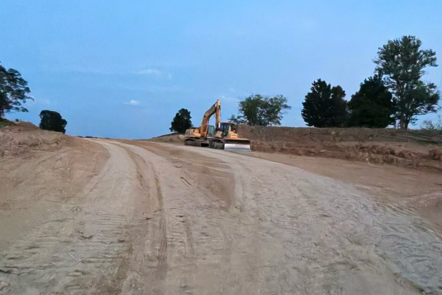
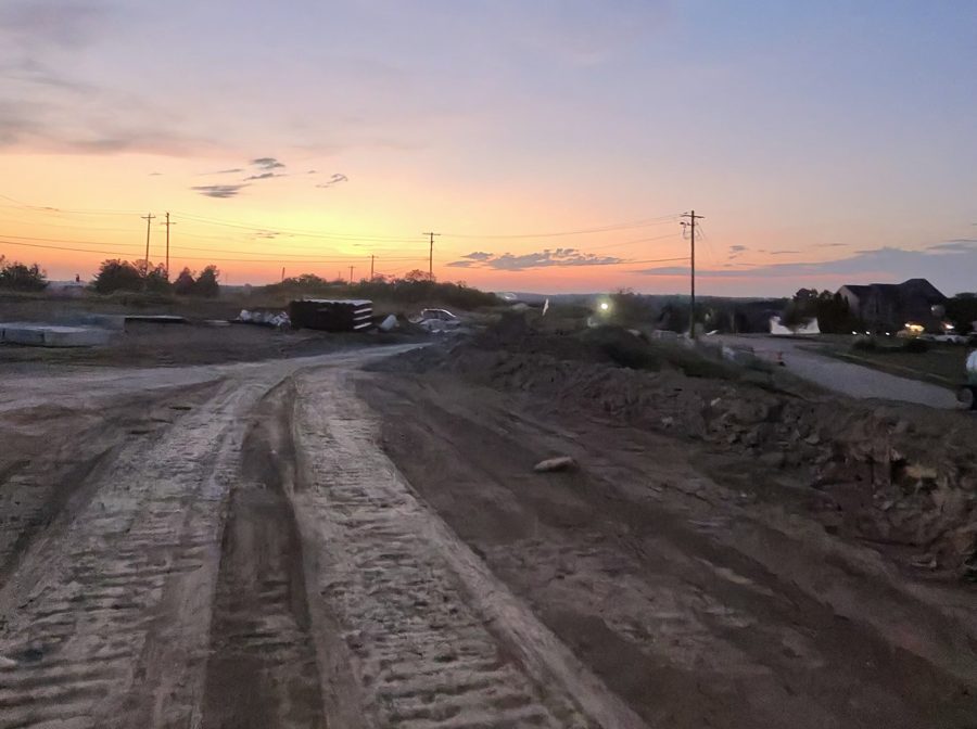
Photographs taken on the ground along the corridor. They are not KYTC material and are not part of any official record.
Project status
KYTC is delivering the built and in-progress corridor in four numbered segments rather than as one job, and the sections further east are separate projects again. This reflects the project hub and conditions on the ground as of September 2026; the hub is the place to check for changes.
In progress
- Project 2: KY 536 from Bristow Road (KY 1303) to Williamswoods Drive1.54 miles, two lanes to four, with multi-use paths both sides and roundabouts at KY 1303 and Hogrefe Road. Started April 22, 2024; $30.75M to Eaton Asphalt. Targeted for summer 2027On the road now: traffic runs on new pavement between Hogrefe Road and Williamswoods Drive, after a switch on February 20, 2026. Only half the roundabout at Bristow and Mt. Zion Road is built, so KYTC asks drivers to treat that intersection as a three-way stop, and the surface shifts between the new and the original pavement either side of it.
- Project 3: Bristow Road (KY 1303) from north of Timber Lane to KY 536Started September 16, 2024. KYTC now says the project was completed in October 2026, with additional corrective work continuing after the final inspectionOn the road now: all lanes are open. Crews are still working on corrective items throughout the project limits, which KYTC expects to have minimal effect on traffic. Use caution and watch for crews.
- Project 4: KY 536 from Williamswoods Drive to Madison Pike (KY 17)Started December 1, 2025. Targeted for fall 2027. Most of it is built on a new alignment north of the existing KY 536, with a new bridge over Independence RoadOn the road now: earthwork inside the project limits, mostly off the existing road, so KYTC expects little effect on through traffic until the roundabout at Williamswoods Drive is built. Lane closures and shifting patterns are expected then.
Projects 2 and 4 together carry the corridor east from the Mt. Zion and Bristow junction to Madison Pike (KY 17). Project 3 runs north from that same junction along Bristow Road. Completion dates and current lane configurations are KYTC's own. The project hub is checked every weekday for updates, and this page is changed as soon as something new turns up.
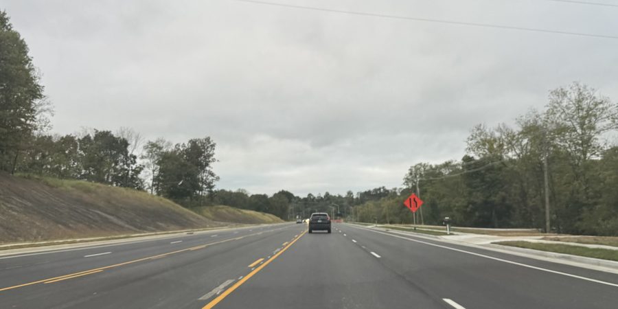
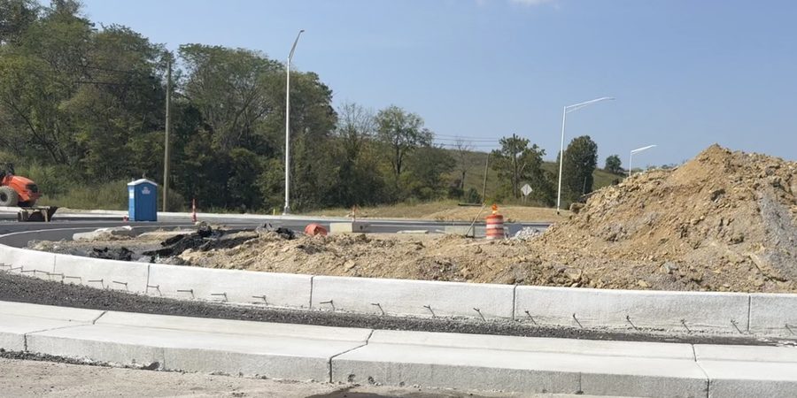
Photographs taken from the road. They are not KYTC material and are not part of any official record.
Still in design
Three more projects carry KY 536 east of Madison Pike. All three are early: KYTC describes construction as several years away for each, and what the map shows are preferred alternatives rather than funded designs.
- 6-80217: KY 536 from Madison Pike (KY 17) to KY 16Preferred alternative identified; construction several years away
- 6-80203: KY 536 from KY 16 to KY 177, at the Campbell County linePreferred alternative identified; construction several years away
- 6-352: KY 536 from U.S. 27 to KY 9, the AA HighwayRight-of-way from U.S. 27 to Persimmon Grove Pike could start as early as 2027
KYTC held public meetings on all three in July 2026 and took written comments until 30 August. Preliminary engineering and environmental studies are finished for the two Kenton County projects, which is how a preferred alternative was chosen.
Completed
Project 1, Dixie Highway (U.S. 25) to Bristow Road, was finished in summer 2024. KY 536 from Union to just shy of where Mt. Zion Road ends at Bristow Road is already done, with great improvements to traffic flow.
The stretch between KY 177 and U.S. 27 has no project on this map because it does not need one: it was widened in 2017 and 2018 under KYTC contract 172225.
Official sources
The Kentucky Transportation Cabinet maintains the authoritative project hub. Go there for current schedules, official mapping, contact information, and any updates that supersede what you see on this page.
KYTC KY 536 Project Hub →ky-536-kytc.hub.arcgis.com